·
Written by
Nicky Evans

Pedal power is a low-cost, high-effort, and incredibly rewarding way to see the world while minimizing your environmental impact. Polarsteps travelers have logged every free-wheeling mile of some of the world’s best long-distance cycling routes. Here are just some of their adventures.
The Silk Road Route

Source: Tiphaine Muller
What is it? This cross-continental bikepacking classic covers 13,000km from Türkiye to China, following historic trading routes through the Middle East and Central Asia. Some cyclists incorporate the Silk Road as part of an even longer journey through South and Southeast Asia to Singapore, the furthest it’s possible to travel continuously overland on the Eurasian continent.
Start/end points: Istanbul, Türkiye, to Beijing, China.
Average duration: 4–6 months (60–100km per day).
Skill level: Advanced.
What’s it like? This bikepacking route is especially challenging because of its extreme nature. You’ll pass through sizzling hot deserts in Turkmenistan and Uzbekistan (often against strong headwinds), and endure altitudes up to 4,600m and freezing nighttime temperatures along the Pamir Highway.
“The oppressive heat in Turkmenistan made the journey almost hellish. We spent the first day cycling from 9pm to 8am, and I caught myself falling asleep on the bike every few seconds… Polarsteps Explorer Tiphaine Muller, who cycled from France to the Himalayas with her partner Pierre.
Highlights: The Bartang Valley route, a 300km off-road mountain trail that runs roughly parallel to the Pamir Highway and offers even more sensational valley views, bigger technical challenges, and a sense of absolute isolation.
“One of the best parts of this trip was cycling the Bartang Valley route. After we left the last few villages behind, we had to push the bikes up to a plateau at 4,000m altitude. A range of snow-capped mountains ahead of us, beautiful ocher colors, and the immense pleasure of riding there, alone. It felt like we were at the edge of the world, flying with the wind behind us, in this remote, untouched terrain. Magical!” See Tiphaine & Pierre’s trip on Polarsteps.
Top route tip: If you want to cycle the Bartang Valley route, time your trip to tackle this section in July and August, when temperatures are at their mildest (but still hover around freezing point at night). And make sure you’ve lined up all the necessary vaccinations, visas, and permits for each country to avoid being delayed, detained, or denied access.
The Polarsteps perspective:
Polarsteps Explorer Elouan Hilbert cycled from France to Japan, following the Pamir Highway and taking his chances in Anzob Tunnel in Tajikistan, nicknamed the “Tunnel of Death”.
“After a 900m climb, I reach the tunnel. A soldier stops me, takes my passport, we go over my entire route using the stamps, he gives it back, and we take a quick photo. He looks at my bike, especially the lights. I show him everything and put on my high-vis vest… I learn that the tunnel is sloped to my advantage. And the asphalt isn't too bad. I'll give it a try! I wait for a break in the traffic and set off for 6km of darkness. The light is dim, the dust and pollution are stifling without ventilation. I'm cruising at 40 km/h… It's incredibly fast… I can't imagine going through this tunnel the other way, uphill.” See Elouan’s trip on Polarsteps.
Polarsteps Explorers Clemence and Solene cycled from Paris to Singapore.
“Setting off to cycle halfway around the world without ever having done it before, what a joke. But with a bit of perseverance (and decent physical fitness), it's possible. I struggled (really), I doubted myself (a lot), but in the end, I loved it. Solene and I saw incredible things, especially the Great Wall of China, which will remain one of the most exceptional moments of this trip.” See Clemence and Solene’s trip on Polarsteps.
Trans-America Trail

Source: Gage Matzen
What is it? A 4,200-mile (6,759km) coast-to-coast route established in 1976 to celebrate the USA’s 200th anniversary. The route follows mainly paved roads through 10 states between the Pacific and the Atlantic, and crosses mountain ranges including the Rockies, the Cascades, and the Appalachians.
Start/end points: Astoria, Oregon to Yorktown, Virginia.
Average duration: 3 months (50–60 miles per day).
Skill level: Intermediate.
What’s it like? Cycling this route teaches you just how diverse each state’s topography is. You’ll be dealing with high desert in the West, relentlessly flat agricultural terrain in the Midwest, and huge elevation gains in the mountains of the East. The network around this trail is also a reminder of human kindness — church-run hostels and individuals from small-town communities often offer free beds or camping pitches to bikepackers.
Highlights: Dip your tire in the ocean before you set off, and when you reach the opposite coast, as per tradition. And enjoy the scenic ride straight through Yellowstone and Grand Teton national parks!
Top route tip: Most people ride west to east for slightly less-steep inclines and longer descents.
The Polarsteps perspective:
Gage Matzen cycled the Trans-American Trail from east to west over 12 weeks in 2022, raising $16,860 for charity.
“My real highlight was meeting and riding with all the friends I made in the first half of the journey. I cycled with 10 people for a good amount of time, and met quite a few more… The heat of the Midwest, the hills of the east, and the mountain passes of the west were all quite challenging on a 95lb bike.” See Gage’s trip on Polarsteps.
Pan-American Highway

Source: Pierre Blivet
What is it? A connection of roads rather than an official trail, this 16,800-mile (30,000km) beast of a ride starts in Alaska and typically skirts the western coast of The Americas, passing through 14 countries across two continents, before finishing in Patagonia. Some travelers only cycle part of this giant route, typically the 6,800-mile (11,000km) stretch through South America, starting in Turbo, Colombia.
Start/end points: Prudhoe Bay, Alaska to Ushuaia, Argentina.
Average duration: 12+ months (50–60 miles per day with rest days and sightseeing time).
Skill level: Intermediate.
What’s it like? You’ll face steep climbs across the Rockies in the north and the Andes in the south, with a loaded frame and (more often than not) extreme weather conditions. The most challenging summit along this “ice-to-ice” route is at Cerro de la Muerte in Costa Rica, where a 28-mile (45km) continuous climb with 2,470 meters of elevation gain awaits to further test cyclists’ endurance.
Highlights: The spectacular scenery!
“I saw glaciers in Patagonia, pitched my tent on a salt pan in Bolivia, cycled up Andean passes to an altitude of 5000m, and watched a volcano erupt.” Polarsteps Explorer Pierre Blivet, who cycled from Ushuaia to Vancouver.
Top route tip: Most cyclists travel from north to south to take advantage of tailwinds, catching a flight or ferry between Panama and Colombia to bypass the 66-mile (106km) Durién Gap. Start the trail in June, when temperatures in Alaska are at their mildest, hit Central America at the end of the rainy season (Sep–Nov), and roll into South America during the southern hemisphere’s summer (Dec–Feb).

Source: Bond Almand
The Polarsteps perspective:
Polarsteps Explorer Bond Almand (who completed the Pan-American Highway in 75 days, 17 hours, and 55 minutes — a world record) tracked his warm-up route around Central America:
“In this part of the world, traffic was a worry. The roads are busy and sometimes in disrepair. The threat of constant rain in the tropics is also a worry as it makes the roads more dangerous, and keeping gear dry is difficult.” See Bond’s trip on Polarsteps.

Source: Imke Fröhling
Polarsteps Explorers George and Imke cycled from Santiago to El Calafete.
“Nothing beats the feeling of achievement you get, especially climbing up to the pass from Argentina to Chile. And the joy of the many, many wild swims… Another highlight was the generosity we received and passed on. The most memorable moments were a Brazilian couple handing us a packet of biscuits after a monstrous gravel climb and George gifting a pair of his wooly socks to a cyclist from Argentina who was cold at night.” See George and Imke’s trip on Polarsteps.
EuroVelo
What is it? EuroVelo is a vast, interconnected network of 17 long-distance cycling routes spanning the entire European continent, following both existing national cycle lanes and purpose-built trails. North–south routes have odd numbers, while east–west routes have even numbers. The transnational project aims to have 90,000km of cycle routes by the time it’s fully completed.
Start/end points: The Eurovelo website contains clear descriptions of each route.
Average duration: The shortest official route is the EV19 (Meuse Valley), whose 1,050km takes an average of 2–3 weeks. The longest official route is the EV13 (The Iron Curtain Trail), which traces 10,500km over 3–5 months. Aim to cycle 50–80km per day.
Skill level: All levels.
What’s it like? EuroVelo is a really flexible network, whether you’re trying out long-distance cycling for the first time, or seeing how far you can pedal across the continent. You’ll experience vastly different cultures, cuisines, and landscapes with each European border you cross, and learn a lot about each region’s history, whether you’re tracing an ancient pilgrimage route or following the wild Atlantic coastline.
Highlights: Europe’s infrastructure makes bikepacking really smooth. The network is well signposted and maintained, and public transport makes it easy to cycle one way and return to your starting point by train, or skip certain sections.
Top route tips: Pick a flatter route if you don’t feel up to tackling alpine climbs, or connect two or more routes into a longer itinerary, like our Polarsteps Explorers!
Chloé Lauvergnier combined the EV12 and the EV1 through Denmark and Norway (starting in France).
Dorian W cycled from Nordkap (the northernmost point of Norway) to Tarifa (on the southern tip of the Spanish peninsula) in 54 days, along the EV7 and the EV8.
Remy Leseigneur rode a 7,508km loop through 21 countries from Longjumeau in France.
The Polarsteps perspective:
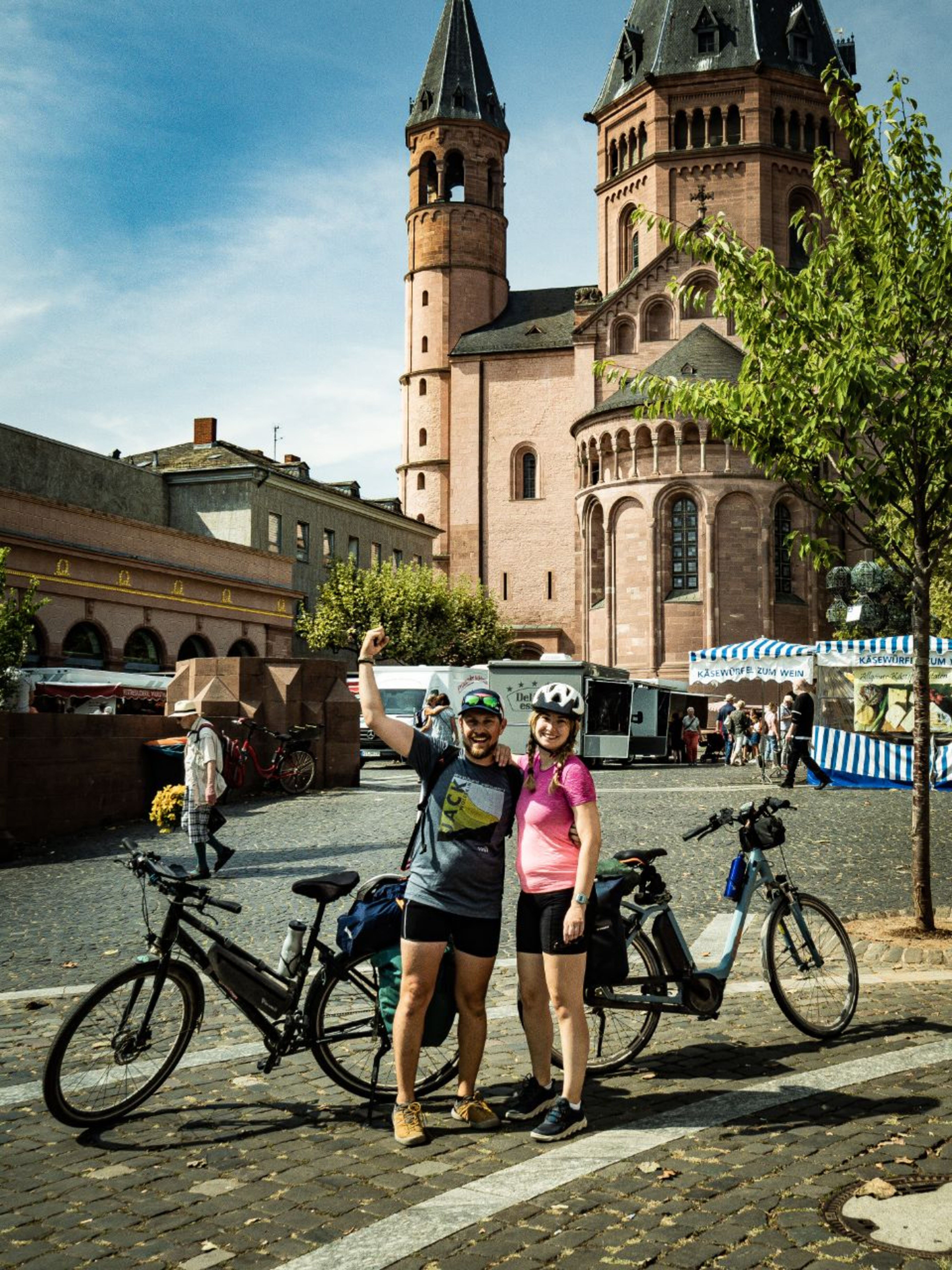
Florian Grashaftl, Lead Android Engineer at Polarsteps, has cycled both the EV15 and the EV19 with his partner Loredana. The EV19 tracks the Maas River from its mouth (at the Hook of Holland) to its source (in Langres, France). The EV15 follows the Rhine from the Swiss Alps to the North Sea.
“We figured out a good balance between cycling and also being a tourist, which for us meant doing an average of only 60–80 km per day and always trying to arrive at our destination by lunchtime so there was plenty of time left in the day to explore. (An added benefit is that we also got the best spots at campsites because usually, people show up later). We learned that 100 euros per day was quite enough money to sustain ourselves and have a place to sleep.” See Florian’s Eurovelo 19 and Eurovelo 15 trips on Polarsteps.
Jess Hall cycled from the UK to Türkiye, picking up sections of various EV routes along the way.
“I'm so glad I took the plunge and started pedaling. It wasn't straightforward, and I wasn't even sure where I was heading for the first few weeks… But my body and some spirit inside of me pushed on… My wee two leggies took me through incredible landscapes where I had the most magical encounters with locals, met some totally amazing cycle buddies… and got to revel in the sunrise-sunset camping cold-dip routine which brings me absolute joy and life!” See Jess’ trip on Polarsteps.
TransAfrica

Source: Thijs Pankras
What is it? Cyclists who talk of doing a TransAfrica bikepacking adventure usually base their route on the classic Cairo-to-Cape Town template, which stretches 10,500–12,000km through 9+ countries along the length of Africa. Historically, the route started in Egypt, but due to ongoing conflict in Sudan, many cyclists now begin their journey in Nairobi. Other bikepackers plot their own adventure across the continent, taking inspiration from the cycling community.
Start/end points: Cairo, Egypt to Cape Town, South Africa.
Average duration: 4–6 months (60–100km per day).
Skill level: Advanced.
What’s it like? Africa poses lots of extra challenges for long-distance cyclists crossing the continent. One hurdle is sourcing replacement parts for your bike — it’s rarely as simple as just placing an order. Other difficulties include extreme heat, dust, and pothole-filled dirt roads. You’ll also need to have visas and vaccinations prepared and triple-checked to make time spent at each border as swift as possible.
Highlights: The way this travel style opens you up to new experiences!
“There’s something about rolling into a small village, smelling the cooking fires before you see them, getting mobbed by curious kids, and observing village life. It’s hands down the best part of this journey.” Thijs Pankras, who cycled from Nairobi to Cape Town.
Top route tip: Most cyclists tackle the route from north to south to have the wind in their favor. Try to build the flagship cycling trails of different countries into your route — Rwanda’s Congo Nile Trail, for example, or the Dragon’s Spine in South Africa.
The Polarsteps perspective:
Read an excerpt from Thijs Pankras’ Polarsteps trip in Tanzania.
July 2, 2024: “The next section will include elephants, lions, buffalos, snakes and… a shitload of tsetse flies… I’m more afraid of these thousands of tsetse flies than of a lion… Voting can begin: which of the above will cause my mental breakdown?”
July 3, 2024: “Possible contender for breakdown so far: absolutely the washboards… They’re another word for hell, continuous bumps that make you think that everything on your bike is going to break.”
July 4, 2024: “Tarmac! 🙏🏻 Smooth as butter, flat as the Netherlands, black as the night, and equally divided into two beautiful parts, separated with a thin but clear line… I settled in on my precious half of bitumen... From working for a bank, to a life where a bit of tarmac and a good lunch could make or break my day.” See Thijs’s trip on Polarsteps.

Source: Meryem Belkihel
Polarsteps Explorer Meryem Belkihel (aka MeghyLost) spent three years cycling 35,000 km around Africa, passing through 34 countries from her home in Morocco to Madagascar (and climbing Mt Kilimanjaro along the way).
“If you’ve been following me from the beginning, you know: I’m the queen of rain and negotiation. In all the countries I’ve crossed, I haven’t paid a single bribe to police. In Ethiopia, rain greeted me right as I reached the border… Immigration started with a health check. Right away, I began chatting and joking, dropping in some Moroccan words, asking questions about Ethiopia, trying to build a friendly atmosphere. Then came the visa office. A bit of back-and-forth, but in the end, I got my stamp with no problems. As a bonus, they only wanted to check my bike, curious how a woman alone could possibly ride all the way to Addis. From the balcony, people leaned over to watch me push my bike through.” See MeghyLost’s trip on Polarsteps.
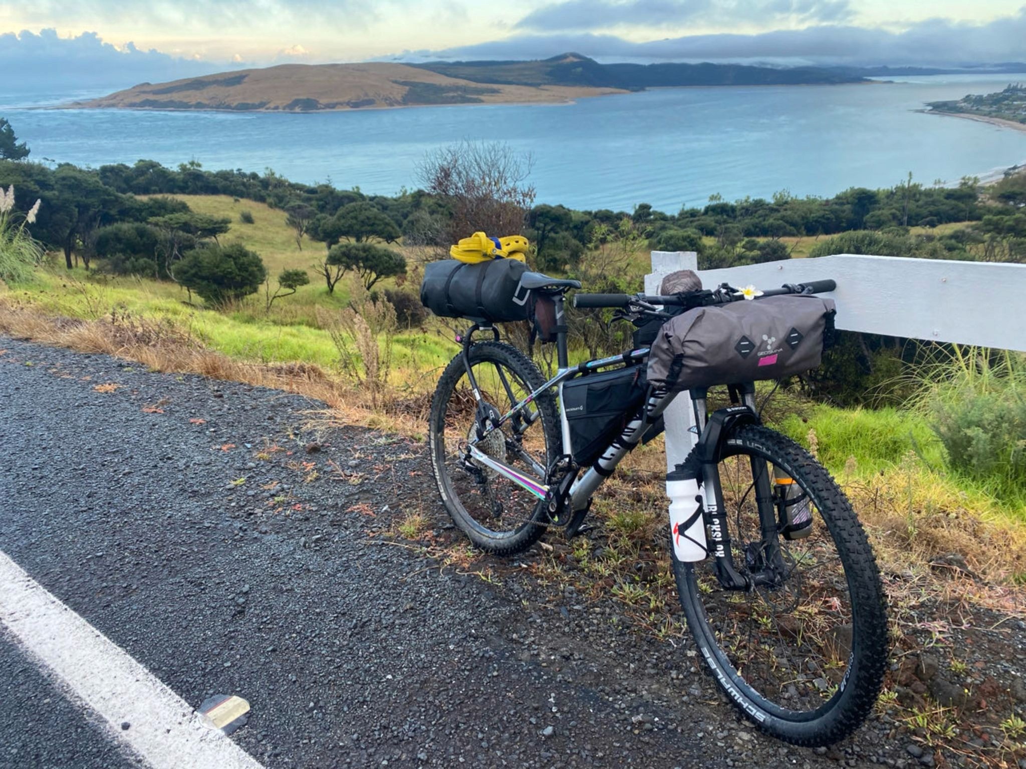
Tour Aotearoa
Source: Laura Andrews
What is it? A 3,000km bikepacking route, Tour Aotearoa spans the length of the country, from the northernmost point of the North Island to the bottom tip of the South Island. It links together the 23 long-distance cycle routes and connecting roads that are part of Ngā Haerenga (The New Zealand Cycle Trail) in a combination of paved and backcountry roads, and technical singletrack.
Start/end points: Cape Reinga (North Island) to Bluff (South Island).
Average duration: Allow 40–50 days (60–70km per day with rest days and sightseeing time).
Skill level: Intermediate,
What’s it like? The route reflects the diversity and magnitude of New Zealand, with the landscape changing almost as quickly as the weather. At different points along the route, you’ll find yourself plowing through miles of sand, navigating deserted ravines, scaling volcanos in national parks, and carrying your loaded bike across swing bridges or over fallen trees.
Highlights: The route incorporates some of the country’s scenic “Great Rides”, such as the Timber Trail on the North Island and the West Coast Wilderness Trail on the South Island.
Top route tip: Most cyclists tackle Tour Aotearoa from north to south, to have the wind at their back. Set off from late February to March for the mildest weather conditions. You can buy paper maps of the official route, or download a PDF version, from the TourAotearoa website.
Source: Laura Andrews
The Polarsteps perspective:
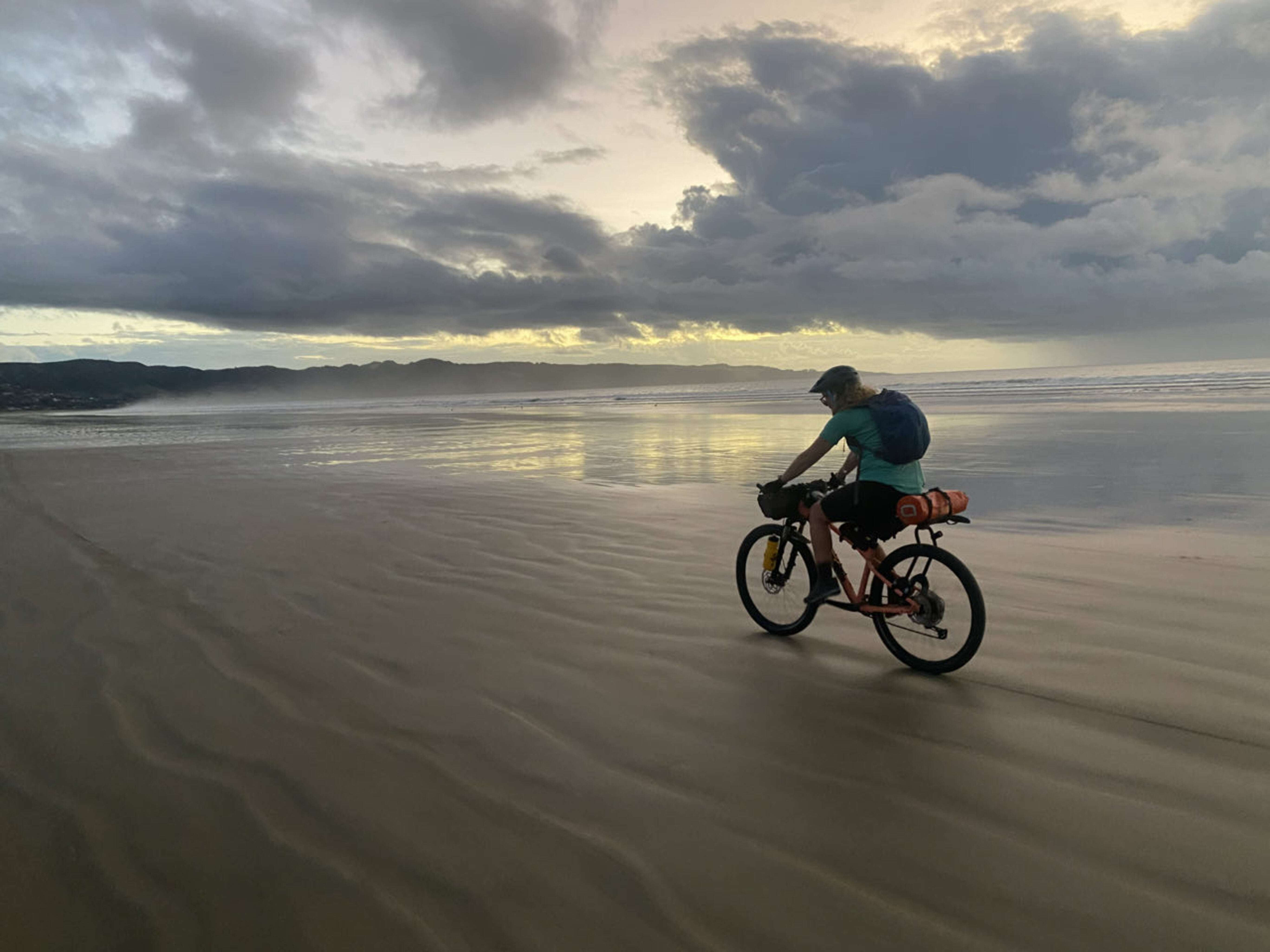
Polarsteps Explorer Laura Andrews completed Tour Aotearoa in just 35 days!
“The 90-Mile Beach is not something to be underestimated. It’s long. Not quite 90 miles long, but the kind of long that’s horizon to horizon, land disappearing into fog. Landforms in the distance seem to take forever to pass by. Today’s tides were definitely a hot topic. High tide was at noon, and the recommended riding window was 3 hours before and 4 hours after high tide. We found out why fairly quickly as our tires sank into the soft sand with our heavy-laden loads. More than once we stalled and rolled to the side, unable to clip out of our pedals fast enough. At 10am we called it. Headed up the beach by a small stream, set up our tent, and lay down to nap for the next 5 hours… At 2pm it was finally time to get out there and give it another go. 60+km along a beach is no mean feat… But we smashed it in a day.” See Laura’s trip on Polarsteps.

Source: Leoni Kolberg
Tempted to saddle up for your own bikepacking adventure? Polarsteps Pioneer Leoni Kolberg shares her cycling set-up on our socials, and your first step is just a click away in the Polarsteps app! |
|---|
Cover image: Bond Almand

Nicky Evans
Polarsteps editor